Get in touch
Route
The Bundian Way is a shared history pathway between Targangal (Kosciuszko) and Bilgalera (Fisheries Beach) that connects the highest part of the continent and the coast via an ancient Aboriginal route.
This pathway brought together the people of the greater region, most notably for ceremonies associated with whaling in springtime at Twofold Bay and moth hunting in the high country during summer.
The Bundian Way is part of a wider network of Aboriginal pathways in Yuin, Ngarigo, Jaitmathang and Bidawal country. These pathways connected the people and their ceremonies, as well as sacred places, and trade routes across the continent.
It is of great significance that you can still walk from the highest part of the country to the coast through relatively natural surroundings following pathways traditionally used for millennia. Substantial parts of these ways still exist in wild country, in National Parks and State Forests.
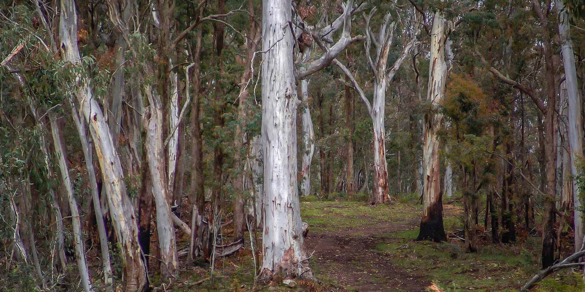
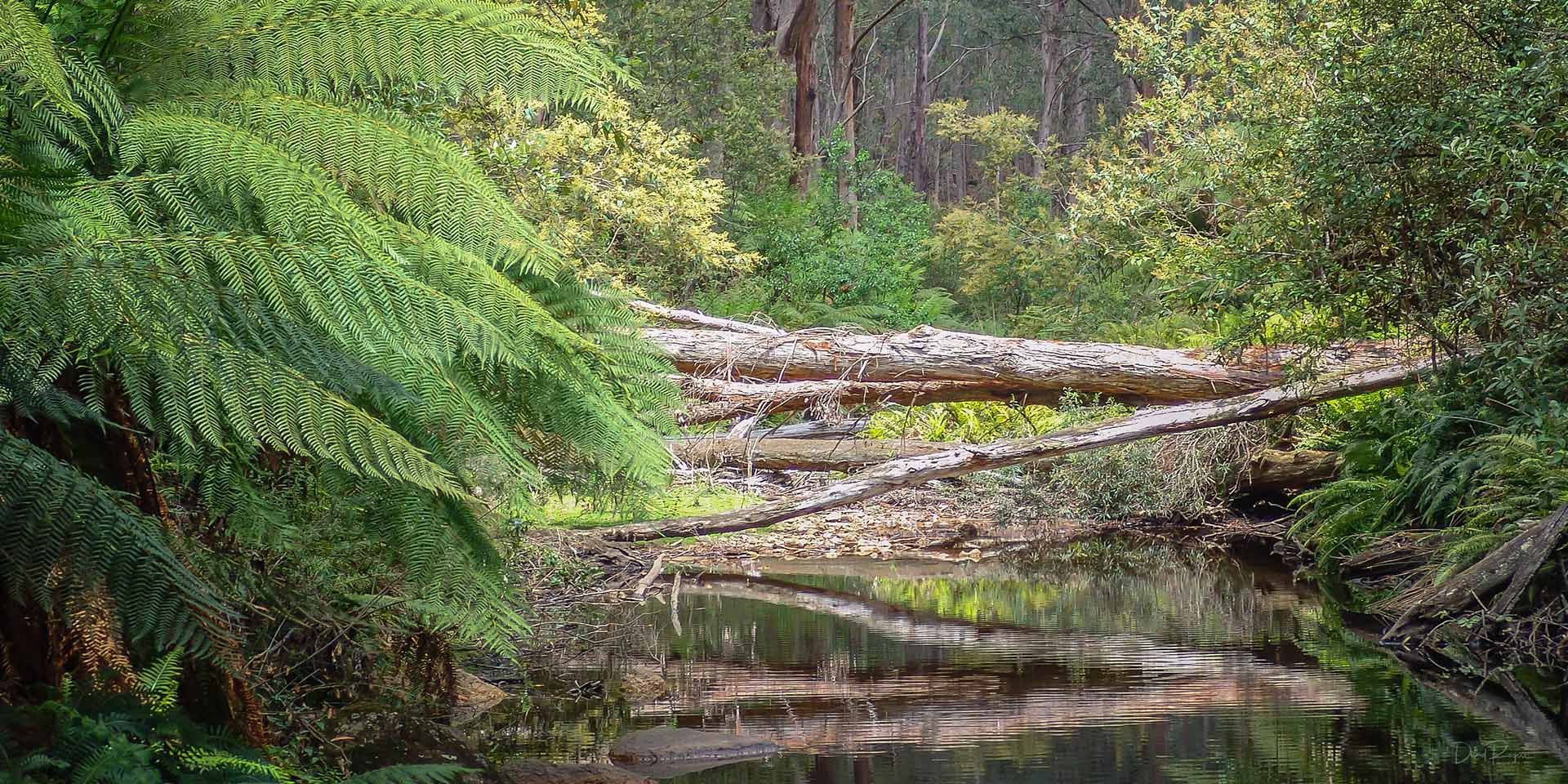
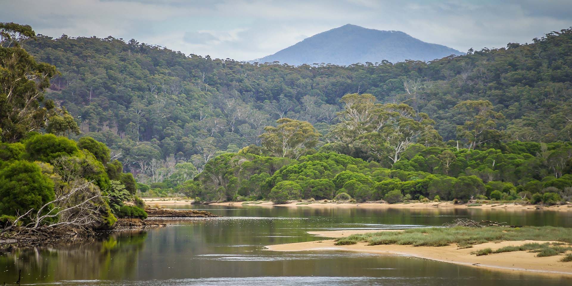
On its way to the coast the Bundian Way crosses the Snowy River and passes through some of the wildest, most rugged and yet beautiful country in Australia. In many parts the influence of the old land management is still obvious in its Aboriginal landscapes.
Total length of the Touring Route is 335km while the Heritage Route from Targangal (Kosciuszko) to Bilgalera (Fisheries Beach) is 265km.
Route Survey
A major survey of the Bundian Way commenced in August 2010 with the purpose of identifying Aboriginal values and landscapes. The first on-ground work began on the Snowy River during October, 2010, and continued into Byadbo, across the Monaro and to Twofold Bay, finishing in November 2011.
The survey crew rotated from leg to leg, including: John Blay, Warren Foster, Darren Mongta, Quentin Aldridge, Derek Davison, David Dixon, Dennis Cruse, Colin Davison, Garry Mongta, BJ Cruse, Brian Mongta, Matthew Mongta, Dennis Arvidson, Lee Cruse, Jolene Brindle, Teneille Stewart, Markita Manton, Brooke Mongta and Muriel May.
You can download a copy of the survey report here.
Bundian Way Route

1
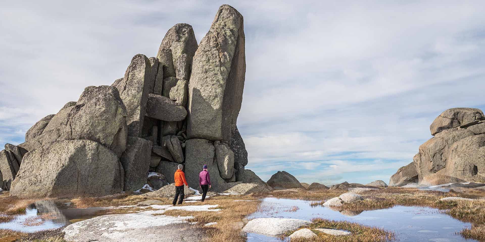
Targangal (Kosciuszko) to Moyangul (Pinch)
The route leads from the summit of the Great Divide to South Ramshead, down to Deadhorse Gap, generally along the Cascade Trail past the Cascade and Tin Mine huts.
It deviates before Freebody’ s to follow the old route from Omeo followed by Surveyor Townsend in 1841-42. The track then proceeds down the Nine Mile Pinch to Moyangul (Pinch River) near its junction with the Nurudj Djurung (Snowy River).
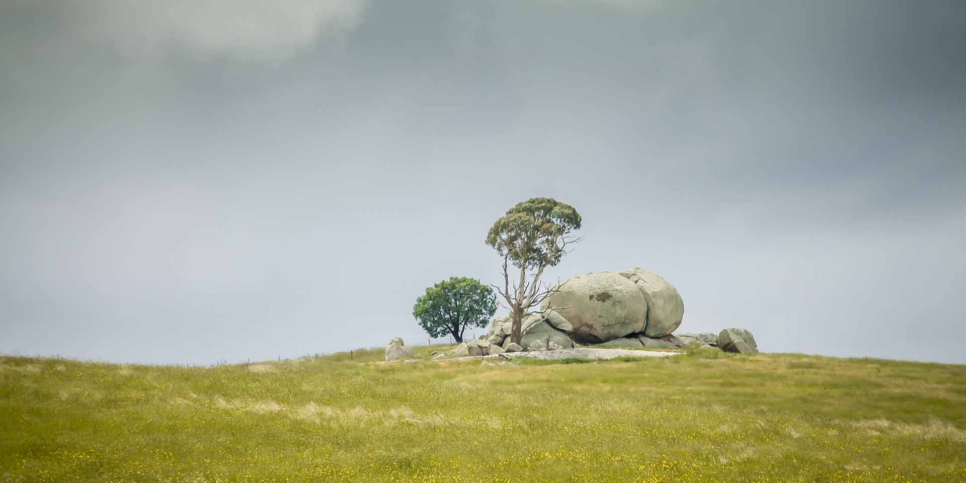
There are outstanding views of the High Country and the Bogong moth places.
2
Moyangul (Pinch) to Merambego
The route follows the old trail beside the Snowy River to the Sandy Creek Trail crossing, then to the crest of the ridge down to Sheepstation Creek. It proceeds beside the creek to the junction with Joe Davis Creek then to the top of the ridge that divides the creeks continuing along the crest 1092m high overlooking Edbo Flat. Following along the old cattleman’ s trail it passes the stockyard toward Byadbo Gap along the Merambego track past the old homestead site to Darrewarra campsite.
It appears one of Townsend’s trees marked in 1841 still stands at the point where he crossed the river, near the Sandy Creek crossing (subject to verification) and further trees marked at intervals of one mile, represent a very significant place.
Byadbo Wilderness suffers extremes of hot and cold, with no water expected after the Snowy, and in dry times none might be available until Corrowong Creek – at least four days walk away.
The most difficult leg of the Bundian Way is through Byadbo. Steep and hard-going, this Snowy River country is both serene and spectacular.
3
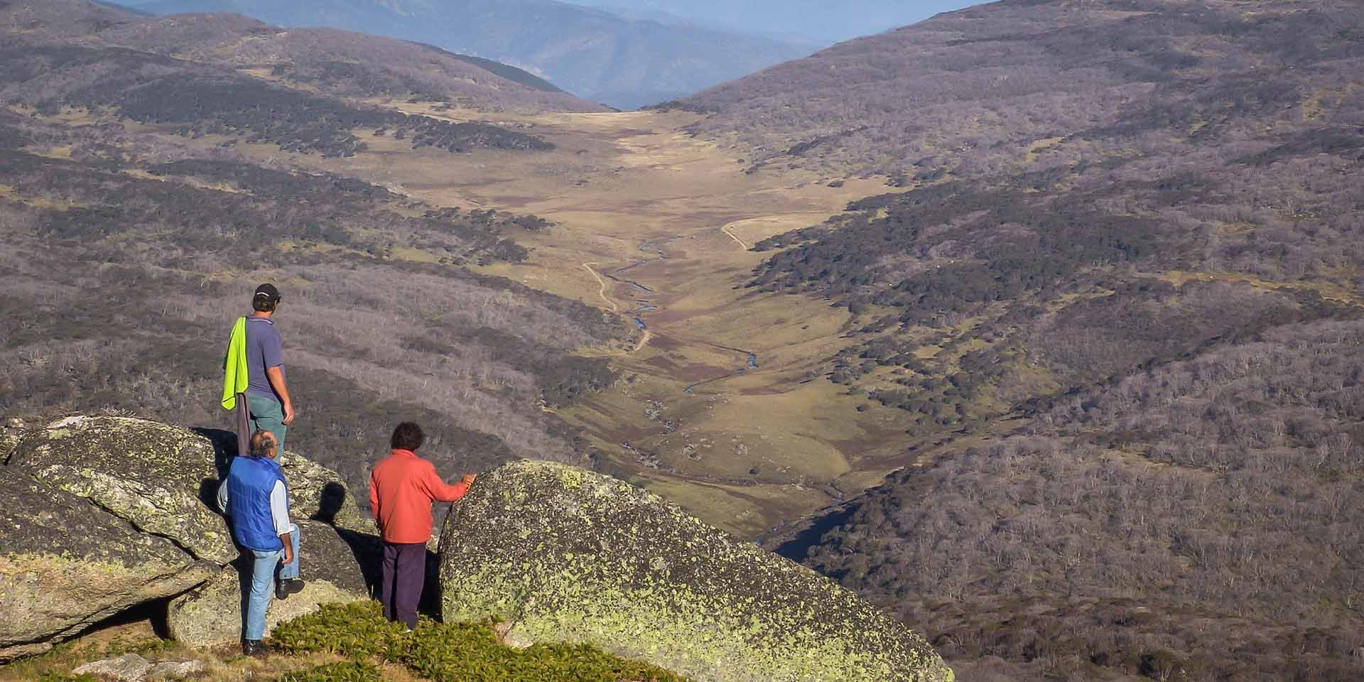
Merambego to Delegate
Viewed from the high country, in the far distance, beyond the wild mountains lies the Monaro, then Balawan (Mount Imlay) and the coast.
During the section across the tablelands there are extraordinary views back along the track from McGuigan’ s Gap. Merambego is a large grassland on the edge of the mountainous Byadbo Wilderness at the far eastern reaches of the Kosciuszko National Park, not far from the NSW-VIC Border and Tingaringy Mountain. It’s truly Man from Snowy River Country. The route follows a track and road through
Wallendibby and Corrowong towards Delegate.
This is the southernmost reach of the treeless plains and demonstrates the ever-changing richness of the Monaro. Due to overwhelming evidence (including artefacts) along the way, it became clear that the Bundian Way should be regarded as a single site.
In many parts the influence of the old land management is still obvious.
4
Delegate to Bondi Springs
The route follows the Craigie and Mila roads, then the shortcut road to the Monaro Highway past various yamfields. A further 1.5km beside the highway are the old Bondi Springs.
The yamfields have special value as an Aboriginal landscape and also educational value as a family and women’s place.
At the foot of the Bundian Pass there is evidence of shared history in the old crossings made by bullockies from Nungatta.
The 265km Bundian Way Heritage Route and the Touring Route of 365km were surveyed by teams of up to five Koori personnel in legs of up to eight days starting on 11th September 2010 and finishing in 2011.
5
Bundian Pass to Towamba
The route follows the ancient Bundian Pass from the Monaro to the coastal plains via the Nalbaugh Falls Picnic area, to the White Rock River. It crosses the gap in the range to Sheepstation Creek, then up the hill beside Surveyors Gully and across Imlay Road. In this section it passes through the magnificent tall forests of the coastal ranges. It then continues via old Rockton Road, Laings Road, Nungatta Road and Poole Road to beside Imlay Road and along old Pericoe Road to finally reach Towamba Hall.
Beautiful wildflowers proliferate through the changing country side.
6
Towamba to Turemulerrer (Twofold Bay)
The heritage route crosses the Towamba River and generally follows the river to Mitchell’s Creek where it goes directly over the crest of the hills and along the ridge tops. Traditionally this was done in one very challenging day. The route then follows the short-cut road to Nullica Flats and Beermuna (Boydtown). Nowadays the walking route passes south of Balawan.
The significant features of this stage include the forests and Balawan (Mt Imlay) views and the arrival at Turemulerrer (Twofold Bay) in Eden, which looks out to Bilgalera (Fisheries Beach), the destination for the old whale ceremonies.